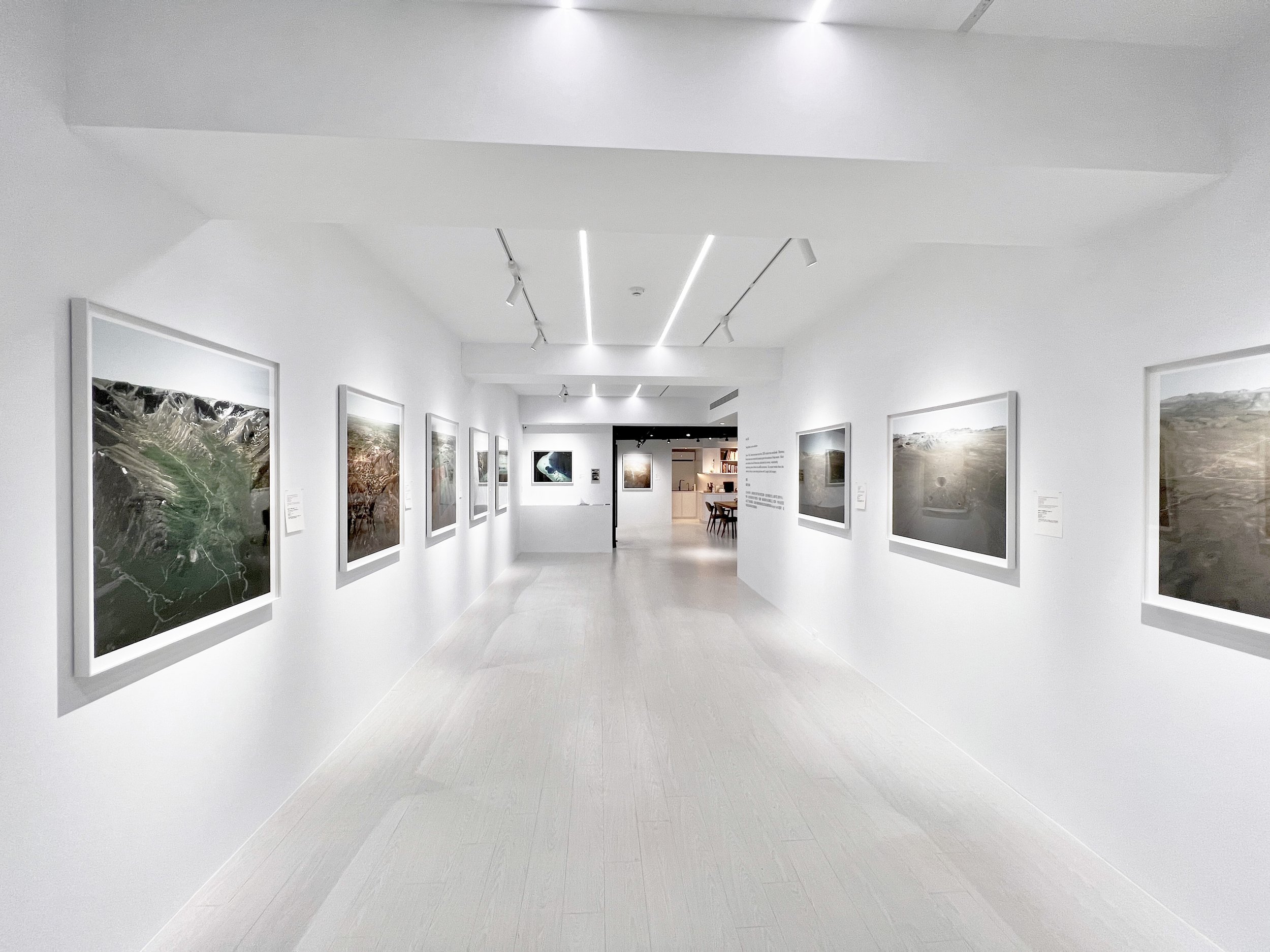
Installation view
Dimensiona variable.
Avocado Art Lab, Taipei.

Trinity, New Mexico, USA (1945)
Yield: 20 Kilotons of TNT
33.6773°N 106.4754°W
Weapon development
eye altitude: 1000m
image date: 2013
First ever nuclear explosion. Trinity was the code name of the first detonation of a nuclear weapon, conducted by the United States Army on July 16, 1945, as part of the Manhattan Project.
三位一體(托立尼提),新墨西哥州,美國 (1945)
相當於20,000噸TNT炸藥
33.6773°N 106.4754°W
武器開發
視覺海拔高度:1,000公尺
影像日期:2013年
人類史上首次核試驗的代號,是曼哈頓計劃的一部分。美國陸軍在1945年7月16日於新墨西哥州索科羅縣的托立尼提沙漠舉行,這次試驗被認為核子時代開始的象徵。

Sedan Crater, Nevada National Security Site, USA (1952)
Yield: 104 Kilotons of TNT
37.1767°N 116.0467°W
Peaceful research
Eye altitude: 700m
Image date: 2006
2nd Plowshare test, cratering experiment, TN device similar to Dominic Bluestone and Swanee, 12 million tons of soil displaced, crater was 1280 x 320'.
薩當彈坑,內華達國家安全區,美國 (1952)
相當於104,000噸TNT炸藥
37.1767°N 116.0467°W
和平研究用途
視覺海拔高度:700公尺
影像日期:2006年
「犁頭計畫」的第二次測試,彈坑實驗,類似「多明尼克藍寶石」和「史瓦尼」氫彈,造成1,200萬噸土壤位移,彈坑1280 × 320英呎。
Operation Whetstone/Sulky, Nevada National Security Site, USA (1964)
Yield: 51 Kilotons of TNT
37.0826°N 116.3435°W
Peaceful research
Eye altitude: 1,000m
Image date: 2010
A Plowshare project for hard, dry excavation test, to study dispersion of radionuclides.
油石行動╱馬車,內華達國家安全區,美國 (1964)
相當於51,000噸TNT炸藥
37.0826°N 116.3435°W
和平研究用途
視覺海拔高度:1,000公尺
影像日期:2010年
一項名為「犁頭」的計畫,作為硬、乾挖掘測試,以研究放射性核素彌散。

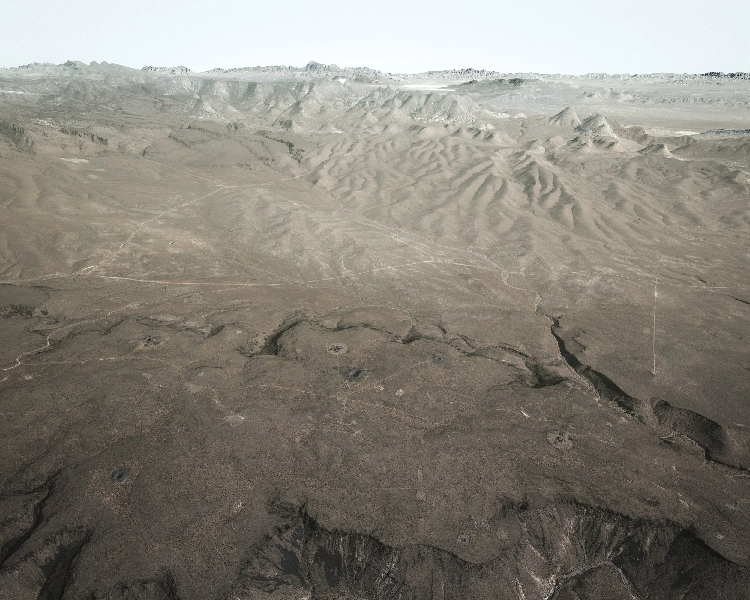
Nevada National Security Site, USA (1951-2017)
Yield: Mostly 500-1,000 kilotons of TNT
37.12°N 116.05°W
Weapon development / peaceful research; 928 tests
Eye altitude: 1,100m
image date: 2003
During the 1950s, the mushroom clouds from the 100
atmospheric tests could be seen for almost 100 mi
(160 km). The city of Las Vegas experienced
noticeable seismic effects, and the distant mushroom
clouds, which could be seen from the downtown hotels,
became tourist attractions.
內華達國家安全區,美國 (1951-2017)
大多相當於500,000-1,000,000噸TNT炸藥
37.12°N 116.05°W
武器開發用途╱和平研究用途,共執行928次測試
視覺海拔高度:1,100公尺
影像日期:2003年
1950年代間在此進行的100次大氣層核試驗所產生的蕈狀雲,遠在距離約100英哩(160公里)處即可看見。
Nevada National Security Site (2015)
Sound design: I-lly Cheng, Conservatorium van Amsterdam
A fly-through video game was created with images of the bomb craters in Nevada National Security Site. The Nevada National Security Site (NNSS), previously the Nevada Test Site (NTS), is home to 928 American nuclear tests. Formerly known as the Nevada Proving Grounds, the site was established on 11 January 1951 for the testing of nuclear devices, covering approximately 1,360 square miles (3,500 km2) of desert and mountainous terrain. The last test was conducted in 1962.
我以美國「內華達國家安全區」創造了一個有著彈坑的飛行視頻體驗遊戲。內華達國家安全區(NNSS)的前身為「內華達試驗場」(NTS),此處曾執行過928次核試驗。它最早被稱為「內華達試驗靶場」,建立於1951年1月11日,用於測試核裝置,面積覆蓋約1,360平方英哩(3,500平方公里)的沙漠和山地。最後一次測試於1962年進行。

Nevada National Security Site, USA (1951–present)
37°07’N 116°03’W
內華達國家安全區,美國 (1951年至今)
37°07’N 116°03’W
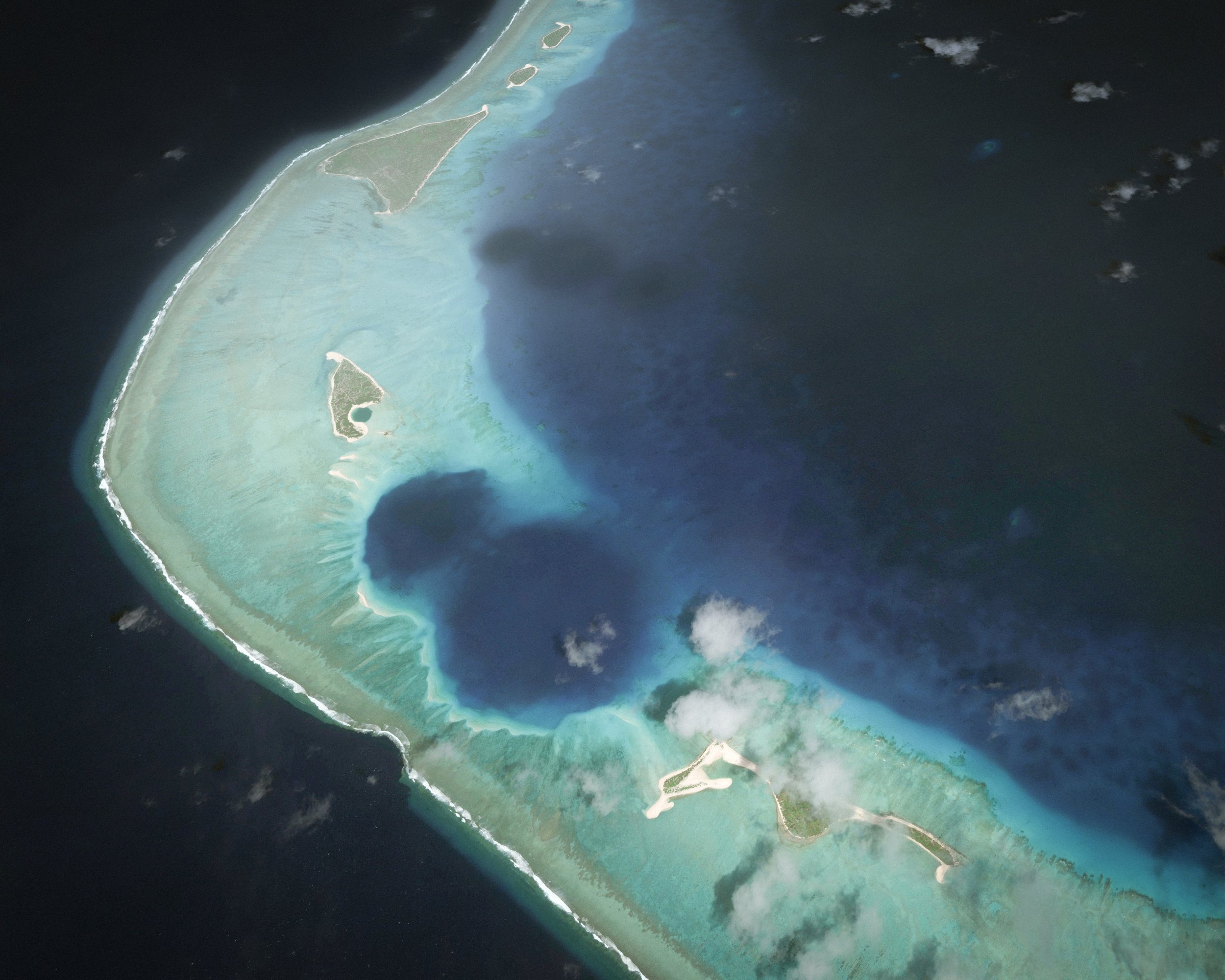
Ivy Mike, Enewetak Atoll, Marshall Islands, USA (1952)
Yield: 10.4 Megatons of TNT
11.6657°N 162.1893°E
Weapon development
Eye altitude: 3,600m
Image date: 2013
常春藤麥克,埃內韋塔克環礁,馬紹爾群島,美國(1952)
相當於10,400,000噸TNT炸藥
11.6657°N 162.1893°E
武器開發用途
視覺海拔高度:3,600公尺
影像日期:2013年

Project Shoal, Fallon, Nevada, USA (1963)
Yield: 12 Kilotons of TNT
39.20012°N 118.38124°W
Peaceful research
Eye altitude: 2790m
Image date: 2014
From Vela project. A set of tests designed to allow scientists to get calibrated seismic and other data from known shots for the purposes of nuclear testing detection and verification. These insights realised the possibility to monitor if Partial Test Ban Treaty and Non-Proliferation Treaty are respected by relevant countries.
沙洲計畫,法倫,內華達,美國 (1963)
相當於12,000噸TNT炸藥
39.20012°N 118.38124°W
和平研究用途
視覺海拔高度:2790公尺
影像日期:2014
船帆座計劃的一部分:這組核武測試是為了讓科學家們取的校準後的震測等資料,用於偵測、驗證核武測試。這些資訊可以用來監測各國家是否有遵守《部分禁止核試驗條約》、《核武禁擴條約》。
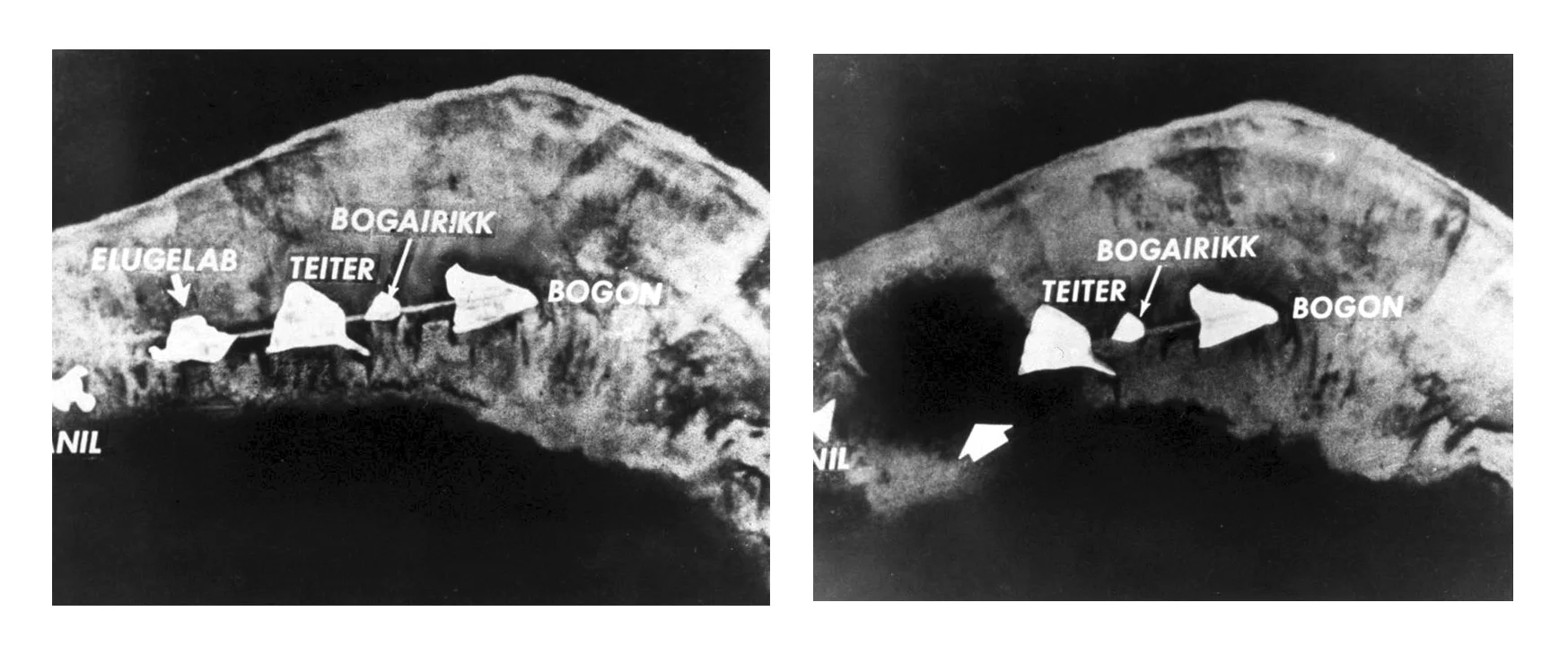
Aftermath of Ivy Mike detonation at Enewetak Atoll (1952)
The two archival images show the Enewetak Atoll before and after the Ivy Mike detonation. Note that the island of Elugelab on the left had disappeared.
Chuck Hansen, The Swords of Armageddon: U.S. Nuclear Weapons Development Since 1945 (Sunnyvale, CA: Chukelea Publications, 1995).
Web Source: Wikimedia Commons
這兩張檔案照是「常春藤麥克」氫彈在埃內韋塔克環礁試爆前後的對照圖,左邊的伊魯吉拉伯島在爆炸後消失。

Castle/Bravo, Bikini Atoll, Namu, USA (1954)
Yield: 15 Megatons of TNT
11.6972°N 165.2719°E
Weapon development
Eye altitude: 5,700m
Image date: 2005
Over twice as powerful as thought, error in assessing Li-7 contribution. Lethal fallout.
城堡行動╱喝彩,比基尼環礁,納木,美國 (1954)
相當於1,500,000噸TNT炸藥
11.6972°N 165.2719°E
武器開發用途
視覺海拔高度:5,700公尺
影像日期:2005年
爆炸威力比預期大了兩倍之多,對鋰7的評估錯誤,造成致命的落塵。

Excerpt from Mondo Cane (1962)

Lira, Western Kazakhstan, USSR (1983-84)
Yield: 5x15 Kilotons of TNT
51.35832°N 53.31979°E
Cavity Excavation (Create reservoirs for gas storage)
Eye altitude: 1700m
Image date: 2006
里拉,西哈薩克斯坦,蘇聯 (1983-84)
相當於5x15,000噸TNT炸藥
51.35832°N 53.31979°E
腔體挖崛(建造天然氣儲氣庫)
視覺高度:1700 公尺
圖像日期:2006 年

Rulison, Colorado, USA (1969)
Yield: 40 Kilotons of TNT
39.4053°N, 107.9485°W
Peaceful purpose, natural gas extraction
Eye Altitude: 9500m
Image date: 2016
魯利森,科羅拉多,美國 (1969)
相當於40,000噸TNT炸藥
39.4053°N 107.9485°W
和平應用,天然氣探鑽
視覺海拔高度:9,500公尺
影像日期:2016年

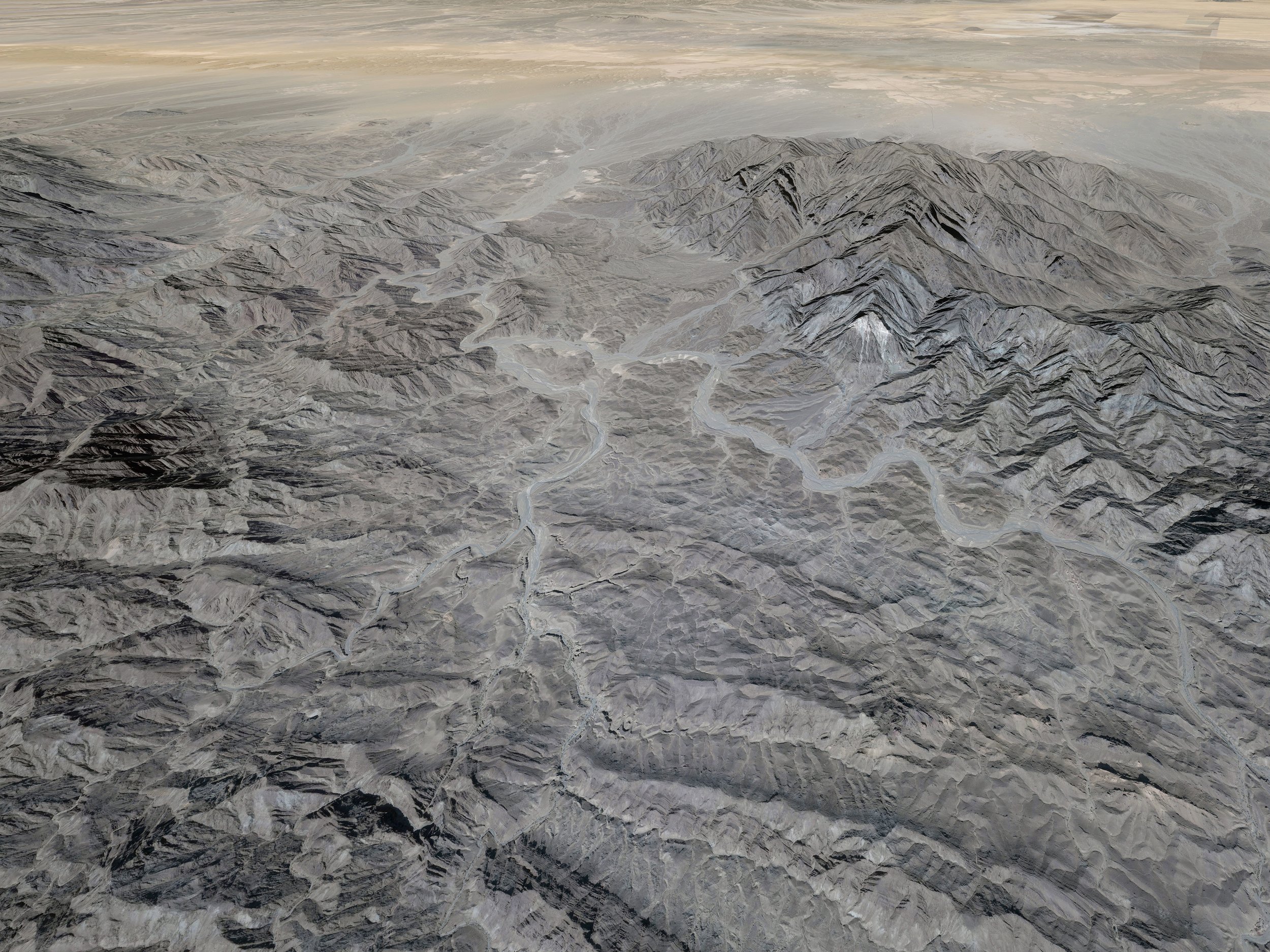
Kirana Hills test sites, Pakistan (1983-1990)
Yield: N/A
31.95743°N 72.69235°E
Weapon development
Eye altitude: 1100m
Image date: 2020
A series of low hills in a populated area in Pakistan, where the Army dug tunnels in which to perform "cold" (zero-yield) tests in preparation for building their nuclear weapon.
基拉納山測試區,巴基斯坦(1983-1990)
TNT炸藥當量未知
31.95743°N 72.69235°E
武器開發用途
視覺海拔高度:1100公尺
影像日期:2020
位於巴基斯坦,在人口稠密處的小丘群。軍隊曾在此處挖隧道,用於進行無爆炸當量的「冷」測試,為自行製造核武做準備
Chagai-I, Ras Koh Hills, Pakistan (1998)
Yield: 1-32 Kilotons of TNT, five simultaneous tests
28.7927°N 64.9457°E
Weapon development
Eye altitude: 3,700m
Image date: 2014
Notice debris from light rock band slumped downhill
from shaking. No official word on what happened in
the test. A. Q Khan, well connected but considered
unreliable, says 1 large and 4 small devices
detonated.
查蓋 I,拉斯山,巴基斯坦 (1998)
相當於1,000-32,000噸TNT炸藥,五項同時測試
28.7927°N 64.9457°E
武器開發用途
視覺海拔高度:3,700公尺
影像日期:2014年
震動造成岩層碎片掉落,官方對此沒有任何表示。

Stavropol, USSR (1969)
Yield: 10 Kilotons of TNT
45.89°N 42.472°E
Peaceful research
Eye altitude: 980m
Image date: 2021
Stavropol contains a single PNE named Stavropol, for gas extraction intensification.
斯塔夫羅波爾,蘇聯(1969)
相當於10,000噸TNT炸藥
45.89°N 42.472°E
和平研究用途
視覺海拔高度:980公尺
影像日期:2021
斯塔夫羅波爾曾進行過一次同名和平用途試爆,用於強化天然氣產能。

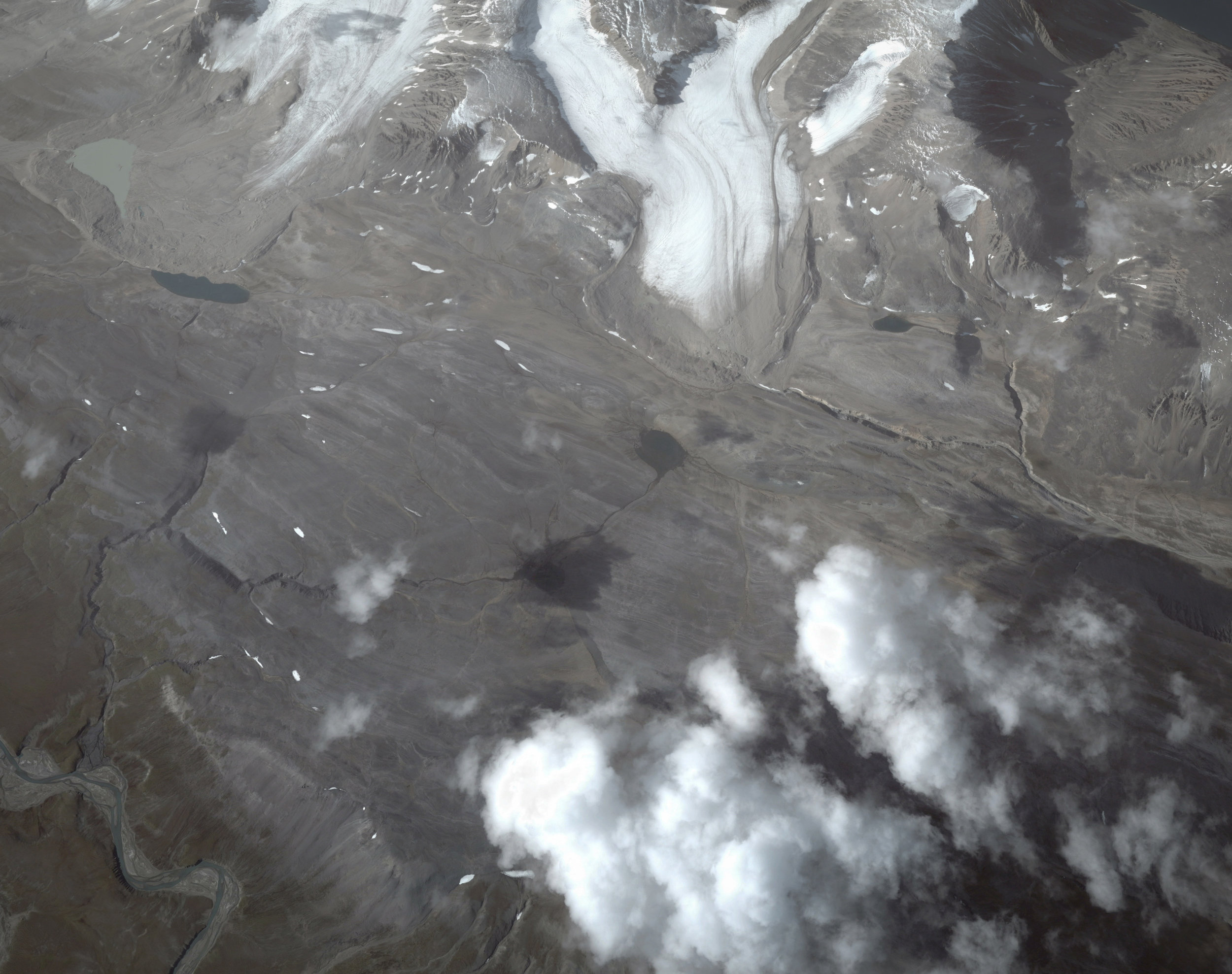
Semipalatinsk Test Site, (Kazakhstan) USSR (1949-1989)
Yield: mostly 10-100 kilotons of TNT
50.116667°N 78.71666°E
Peaceful research
Eye altitude: 3160m
Image date: 2016
The Semipalatinsk Test Site (STS) was the primary testing venue for the Soviet Union's nuclear weapons. The Soviet Union conducted 456 nuclear tests at Semipalatinsk with little regard for their effect on the local people or environment. 1.5 million people were exposed to fallout over the years. This images shows the Degelen Mountain complex (49.78291°N 77.96691°E).
塞米巴拉金斯克基地,(哈薩克斯坦)蘇聯(1949-1989)
大多相當於10,000-100,000噸TNT炸藥
50.116667°N 78.71666°E
和平研究用途
視覺海拔高度:3160公尺
影像日期:2016
塞米巴拉金斯克基地曾是蘇聯主要的核武器試驗基地。蘇聯曾在此進行456次核武測試,但並不關心對當地居民與環境造成的影響。這段期間超過一千五百萬人接觸了輻射落塵。此影像為傑格倫山群 (49.78291°N 77.96691°E)。

Klivazh (Cleavage), (Donetsk region of Ukraine) USSR (1979)
Yield: 300 tons of TNT
48.21336°N 38.28162°E
Peaceful research
Eye altitude: 1900m
Image date: 2018
The Donetsk region of Ukraine hosted a single PNE name Klivazh (Cleavage), a shot designed to relieve gas pressure in a coal deposit. The mine resumed normal operations the following day. After the Soviet Union collapsed, Ukraine inherited large amount of nuclear weapons, making it briefly the world’s third-largest nuclear power. In exchange for security assurances, Ukraine signed the Non Proliferation Treaty in 1994 and transferred the weapons to Russia.
裂谷,烏克蘭頓涅茨克區,蘇聯(1979)
相當於300噸TNT炸藥
48.21336°N 38.28162°E
和平研究用途
視覺海拔高度:1900公尺
影像日期:2018
烏克蘭頓涅茨克區唯一一次和平用途試爆「裂谷」,目的是為一個煤礦床減壓。該礦坑翌日即恢復正常運作。蘇聯解體時在烏克蘭遺下大量核子武器,使烏克蘭一度成為第三大擁有核武的國家;為換取安全保障,烏克蘭於1994年簽署《核武禁擴條約》並移交核子武器給俄羅斯。

Kristall, USSR (1974)
Yield: 1.7 Kilotons of TNT
66.4572°N 112.3988°E
Underground shaft, earth moving
Eye altitude: 5,000m
Image date: 2013
Designed to build a dam on the Deldyn River; was to be first of 8, but project was scrubbed by high radioactivity. Original crater covered with dirt from mine nearby. 90 km NE Aikhal, Yakutia.
晶體,蘇聯 (1974)
相當於1,700噸TNT炸藥
66.4572°N 112.3988°E
地下豎井,土方工程
視覺海拔高度:5,000公尺
影像日期:2013

Rubin 2, Yamalo-Nenets, USSR (1988)
Yield: 15 Kilotons of TNT
66.28°N 78.491°E
Seismic sounding
Eye altitude: 900m
Image date: 2004
Yamalo-Nenets, Russia. underground shaft (-830m), seismic sounding
紅寶石二號,亞馬爾.涅涅茨,蘇聯 (1988)
相當於15,000噸TNT炸藥
66.28°N 78.491°E
地震測探用途
視覺海拔高度:900公尺
影像日期:2004
俄羅斯亞馬爾.涅涅茨。地下豎井(-830公尺),震測。

Lake Chagan, Semipalatinsk, USSR (1965)
Yield: 150 Kilotons of TNT
49.9241°N 79.0107°E
Peaceful nuclear explosions for earth-moving purposes (such as creating artificial lakes)
Eye altitude: 2,500m
Image date: 2010
查干湖,塞米伊,蘇聯 (1965)
相當於150,000噸TNT炸藥
49.9241°N 79.0107°E
和平應用,用於土壤位移(例如製造人工湖)
視覺海拔高度:2,500公尺
影像日期:2010年
Tsar Bomba, Severny Island, part of Novaya Zemlya, USSR (1961)
Yield: 50 Megatons of TNT
73.8072°N 54.9817°E
Weapon development
Eye altitude: 3,500m
Image date: 2013
Largest H-bomb in history.
沙皇炸彈,謝韋爾內島,屬新地島,蘇聯 (1961)
相當於50,000,000噸TNT炸藥
73.8072°N 54.9817°E
武器開發用途
視覺高度:3,500公尺
影像日期:2013年
史上最大氫彈

CHIC-15, Area D (Drop Area), Lop Nur, PRC China (1973)
Yield: 3 Megatons of TNT
40.7985°N 89.8091°E
Weapon development
Eye altitude: 2170m
Image date: 2013
High altitude explosion.
CHIC-15,D區(空投區)羅布泊,中華人民共和國 (1975)
相當於3,000,000噸TNT炸藥
40.7985°N 89.8091°E
武器開發用途
視覺高度:2170公尺
影像日期:2013年
高空引爆

CHIC-17, Area B (Qinggir), Lop Nur, PRC China (1975)
Yield: 3 Kilotons of TNT
41.375°N 88.326°E
Weapon development
Eye altitude: 2170m
Image date: 2013
Underground tunnel, in a tunnel in Bei Shan (North Mountain).
CHIC-17,B區(辛格爾)羅布泊,中華人民共和國 (1975)
相當於3,000噸TNT炸藥
41.375°N 88.326°E
武器開發用途
視覺高度:2170公尺
影像日期:2013年
在位於北山的地下隧道內
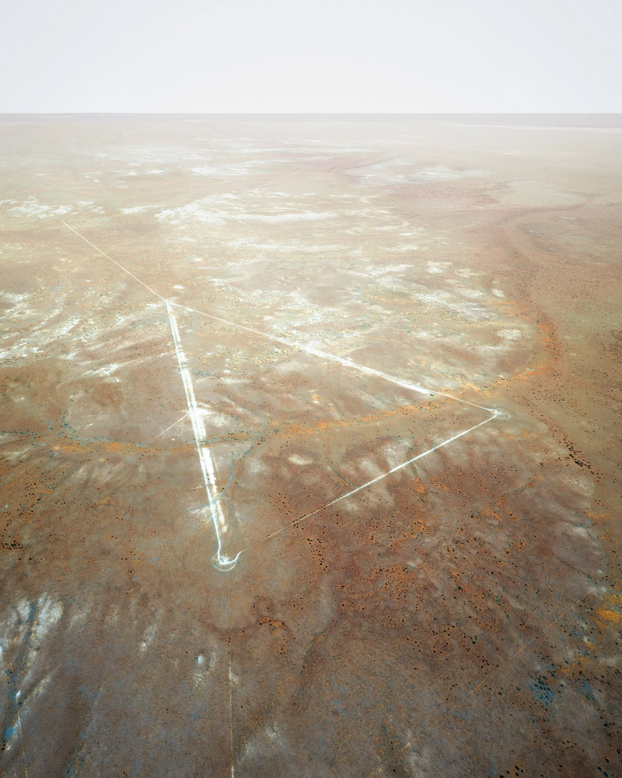
Operation Totem, Emu Field, South Australia (UK test) (1953)
Yield: 8-10 Kilotons of TNT
28.6983°S 132.3714°E
Weapon development
Eye altitude: 1,000m
Image date: 2013
It was later found that the radioactive cloud from the first detonation did not disperse as expected, and traveled north-east over the Australian continent. There are now stone monuments at the ground-zero points, which can be visited by tourists.
圖騰行動,伊姆場,南澳 (英國測試) (1953)
相當於8,000至10,000噸TNT炸藥
28.6983°S 132.3714°E
武器開發用途
視覺海拔高度:1,000公尺
影像日期:2013年
第一次引爆後的放射性雲後來被發現朝東北方飄向澳洲大陸,沒有如預期般散去。

Punggye-ri Nuclear Test Site, North Korea (I) (2017)
Yield: 250 kilotons of TNT (estimate by NORSAR)
41.343°N 129.036°E
Weapon development
Eye altitude: 4,430m
Image date: 2017
豐溪里核試驗場,朝鮮 (1) (2017)
相當於250,000噸TNT炸藥(挪威地震研究中心估計)
41.343°N 129.036°E
武器開發用途
視覺海拔高度:4,430公尺
影像日期:2017年

Punggye-ri Nuclear Test Site, North Korea (II) (2017)
Yield: 250 kilotons of TNT (estimate by NORSAR)
41.279964°N, 129.086253°E
Weapon development
Eye altitude: 2,920m
Image date: 2018
豐溪里核試驗場,朝鮮 (II) (2017)
相當於250,000噸TNT炸藥(挪威地震研究中心估計)
41.279964°N, 129.086253°E
武器開發用途
視覺海拔高度:2920公尺
影像日期:2018年
Fallout
落塵 2015-2022
photographs, video gameplay (dimensions variable)
Since 1945, there have been more than 2000 nuclear tests worldwide. Oftentimes, the test sites are so remote that people ignore the existence of these events. But the tests do exist. Fallout and radiation have left these sites undisturbed by humans, inadvertently transforming some of them into animal sanctuaries. In project Fallout, landscapes from these test locations are assembled - 3D satellite imageries are constructed through coordinates from historical archives. A fly-through video gameplay was created with the bomb craters in Nevada National Security Site, where 928 nuclear tests took place.
Sound design: I-lly Cheng
自1945年來,人類曾在各處進行兩千餘次核武試爆;這些測試位置人跡罕至,對許多人來說好似不曾發生。然而它們確實發生過。落塵、輻射讓許多試爆區無法被人再利用,但部分區域也因數十年無人打擾,成了野生動物聚集棲所。在Fallout計劃中,透過歷史座標資料蒐整,試圖以立體衛星圖資重現各地核測試的痕跡,並以電玩遊戲的角度飛躍美國內華達州數百個核彈坑。
聲音設計:鄭伊里
